
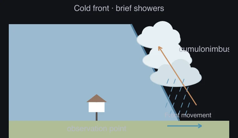
Meaning and mechanism
In cold fronts, cold air advances toward warmer air, and in warm fronts, warmer air advances toward cold air. This is distinguished by the relative movement.
Rising warm air can cool and form clouds and precipitation. The boundary’s slope, water vapor, and stability affect the width and intensity of precipitation.
Relationships and conditions
If you divide the width of a rain area by the speed of movement, you can compare the passing time at a specific point. The temperature, pressure, and wind direction are read together on the same time axis.
The simulation presents a typical scenario; real weather fronts depend on terrain and low-pressure structure. Do not generalize one graph shape into an observational rule for all fronts.
What to observe in the simulation
Observation points experience different perspectives of the same front. Precipitation width and movement speed together change the precipitation duration.
These are the virtual temperature, pressure, precipitation, and wind direction that created a typical scenario. We only cover uniform speed fronts and example winds in the Northern Hemisphere. It is not an actual forecast because it omits the actual terrain, season, water vapor amount, and low pressure structure.
Key relationships and symbols
ΔT0 after cold passage
| Symbol | Meaning | Unit |
|---|---|---|
| Movement speed | Speed of the front or precipitation zone | distance/time |
| Duration | Timescale given by width divided by speed | Time |
Worked example
What are the typical precipitation and temperature changes of a warm front?
A cold front is expressed by a steep slope, cumulonimbus clouds, short precipitation, and a drop in temperature after passing, while a warm front is expressed by a gentle slope, nimbostratus clouds, extensive precipitation before passing, and a rise in temperature.
Common misconceptions
- It is not the case that rain falls for the same amount of time at every location when a wire passes through.